In the post Set Up Your Compass Faster & More Accurately With A Map Protractor I showed the readers how to navigate quicker and more accurately with a map and any compass using a map protractor.
Here are a couple additional tips…
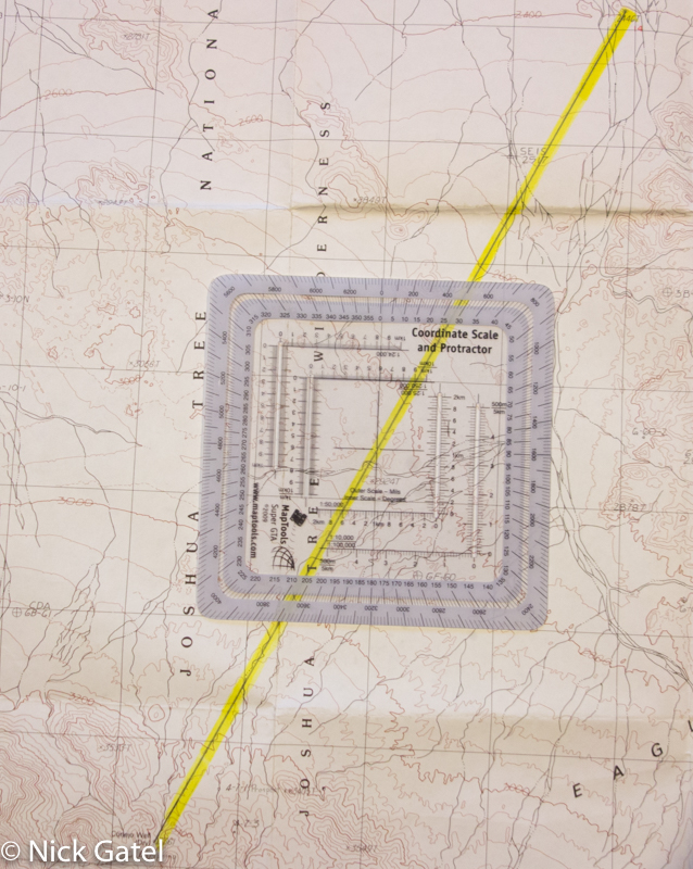
If you recall, the first step is to draw a line between two points, A and B, A being your starting point and B your destination. Then the map protractor is used to determine your bearing.
No Pencil or Straight Edge?

But what if you don’t have a straight edge and/or a writing instrument to draw a line?
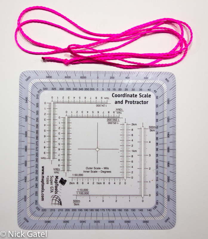
No problemo! All you need is a piece of string, thin tent guyline, thread, or even dental floss.

Tie a knot in one end of the string, and thread the other end through the center hole in the map protractor. Align the map protractor along a north/south gridline, while stringing you line on top of points A and B. The string will pass under the bearing reading.

In the picture above, the string shows our bearing as 55˚. Easy, peasy. For more information on compensating for declination read Part 1 and Part 2.
Measuring Distances
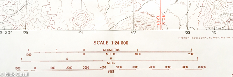
Every USGS Topographical Map has a scale printed at the bottom of the map. The most common map, the 7.5 minute map has a scale of 1:24,000.

What this means is a measurement on the map, be it inches, feet, millimeters, etc. is equal to 24,000 of the same measurement on the ground. So 1″ on the map is equal to 24,000″ on the ground. If you had a ruler, you could measure the kilometer or the miles scale and then measure the distance on the map and calculate. Of course inches isn’t a good “on the ground” measurement. If we divide 24,000 by 12 (12 inches in a foot), we would get 2,000 feet — meaning 1″ on the map equals 2,000′ feet on the ground.
But since you have a map protractor, it can measure for you. My map protractor has 4 scales in the center:
- 1:24,000
- 1:25,000
- 1:50,000
- 1:100,000

Using the 1:24,000 scale, you can see the total length of the scale is 1 kilometer, major tick marks are 100 meters, and minor tick marks are 10 meters. No math needed unless you are metric Luddite. If you are, then this conversion might help 🙂
- 10 meters = 10.93 yards (which would be a first down in football)
- 100 meters = 109.36 yards (nine yards longer than a football field)
- 1,000 meters = 1 kilometer = .62 miles
Where’s Waldo?

If you understand and use UTM coordinates, which is beyond the scope of this post, you can use your map protractor to determine an exact point on the map. This would be useful for directing artillery fire or communicating to someone an exact point.
Most USGS Topo 7.5 minute maps printed in the past 30 years have UTM grids that are exactly 1 kilometer wide and tall, which exactly matches the 1:24,000 scale — how convenient! Older maps don’t have the grids, but many have tick marks in the margins. Keep in mind that if your map has the gridlines, these are the black grids, NOT the red gridlines. Red gridlines are land survey markings, usually (but not always) a quarter section. A section is 640 acres and is 1 mile by 1 mile, so 4 contiguous red squares are probably a section. You should have learned about sections in your high school geography class, if you were awake.

If you look closely at the picture above you will see the 1:24,000 scale lines up perfectly with the bottom and right borders of a UTM grid.
If you think this is a valuable skill or just want to learn more, this link provides more information on using a map protractor with UTM grids.