In case you think I misspelled the title, according to the Merriam-Webster Dictionary, Oases, is the plural of Oasis. But on to the story.
Yesterday morning, when I awoke, it somehow occurred to me that it would be a good day to hike to a Palm Oasis.
I didn’t have any specific oasis in mind.
There is something like almost 200 palm oases within a hundred mile radius of our house, so there were many to choose from. One I had never visited, the Dos Palmas Preserve, is actually a whole bunch of oasis in one huge area — not the few isolated palm tress we often visualize as an oasis.
So I jumped into the truck and made the 60-minute drive to the Dos Palmas Preserve, which is administered by the Bureau of Land Management.
A Few Palm Oasis Facts
The only native palm tree in the Southwestern United States is the California fan palm (Washingtonia filifera) and these are the trees in our local oasis. The Mexican fan palm is common in our area as a landscape tree. I have both in our yard. The California fan palm is wider and takes longer to grow; i.e. the Mexican fan palms I planted in the ‘70s are nearly twice as tall as the California palms I planted at the same time. But the California fan palms are almost twice as big in diameter.
Palm Trees need a lot of water, so they were an indicator of water for ancient travelers. Seasonal streams, such as those at the base of the San Jacinto Mountains where we live can be the primary source of water. Many of the palm oases near us are fed by springs.
The California fan palm can grow as high as 75 feet with a diameter of 40 inches. It is the most massive of any endemic palm tree in North America.
So how do these trees propagate in remote locations, often a great distance from other oases? One way is by coyotes that eat the fruit from the tree, which are mostly seeds. It is common to see coyote scat full of palm berries, and it has been found that seeds from coyote scat germinate much easier and quicker than seeds that simply fall from the trees. Since coyotes can travel up to 36 miles in three days, which is the longest time the seeds can remain in their digestive tract, this is one method. Native Americans probably planted seeds at some springs, since the trees were a source of food, building materials, and other uses. But in our area, most of the palm oases were probably the result of coyotes.
In the area we live, seismic movement underground, mostly along the San Andreas Fault, created the springs in the otherwise dry and harsh environment that runs from the San Bernardino Mountains all the way past the Salton Sea.
These palm oases are important for the survival of many birds and animals.
And that is where I went. Dos Palmas is located northeast of the Salton Sea. Dos Palmas means Two Palms in Spanish. Perhaps at one time there were only two palm trees there? Now there are thousands of palms.
The Salton Sea
I’m surprise how many people know little or nothing about the Salton Sea.
The Salton Sea is the largest lake in California at almost double the surface area of the second largest, Lake Tahoe. The surface of the Salton Sea is around 236 feet below sea level.
For millions of years the Colorado River would occasionally flow into the Salton Sink, bringing fertile soil and filling the sink. These flows would typically happen every 400 or 500 years. If the cycle was too long, the lake would evaporate and disappear. In the 1600s the Salton Sea existed and was know as Lake Cahuilla. By 1700 it disappeared and the area was farmland, salt mines, and even small towns and Native American Villages.
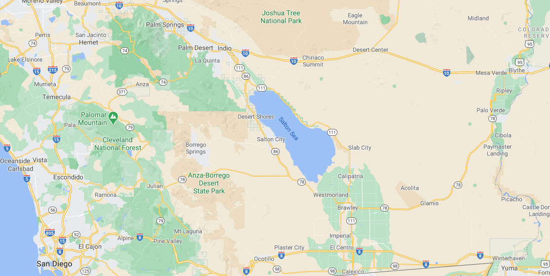
So let’s look at the map below I copied from Google Maps. At the very right bottom is Yuma, Arizona. Above Yuma is the Colorado River and much is colored green, which indicates farmland.
In 1900 the construction of irrigation canals from the Colorado River to the Imperial Valley began. In a couple of years the canals began to back up with silt and then in 1905 the Colorado swelled due to heavy rainfall and snow melt, breaching the irrigation canals. Unable to stop the river, the entire Colorado River (there were no dams on it back then) drained into the Salton Sink for two years. Keep in mind that the driving distance from Yuma to the south end of the Salton Sea is about 100 miles. Mother nature is powerful.
When the river receded, the new lake, a fresh water lake, was created. Every year the Salton Sea becomes more saline and today it is saltier than the ocean. Up until the 1950s the Salton Sea was a popular tourist resort for boating, water skiing, and fishing. By 1960 most of the native fish began to die due to the high salinity. You can read more in this article on Wikipedia.
Dos Palmas Preserve Parking Area
The parking area is about 1 mile north of the edge of the first oasis at Dos Palmas, so you have to walk. But just northwest of the parking area is another palm oasis, San Andreas Palm Oasis that is supported by San Andreas Spring. So I hiked there first.
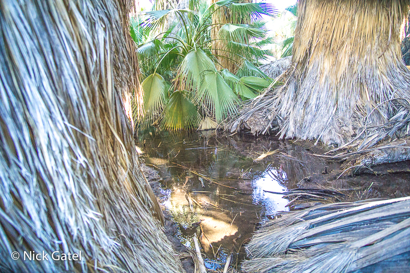
The most striking thing about both San Andreas Oasis and Dos Palmas is the number of trees and how thick and close together the palm trees are. A thick forest of palm trees. For the most part, one can’t walk through them. Given the thick undergrowth and debris from palm fronds, one wouldn’t want to try, especially with the risk of a rattlesnake bite. So here are a few pictures of San Andreas Spring Palm Oasis.
San Andreas Spring Oasis
At the bottom center of the picture below you can see a palm tree that doesn’t have a top crown. This is because the tree has died. When that happens the crown falls off.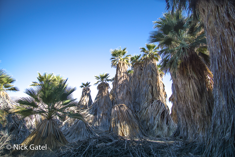
Also note that the dead fronds have drooped down from all the trees creating a skirt like covering hiding the trunk of the palms. The ground is covered with dead pieces of fronds, and other palm tree parts creating a thick underground of debris. When used for landscaping, each year the dead fronds are usually trimmed and hauled away. At our house, the trees have grown so tall, each year I have to pay someone to climb up the trees and trim them.
In some areas close to where the spring water rises above the ground surface, ponds are created, but some areas in an oasis, the ground is dry, with just enough underground water to keep the trees alive.
Click on images below to view the full size.
Dos Palmas Oases
There are several springs that create individual oases, all close together. Also, the eastern edge of the area is bordered by the 122 mile Coachella Canal that brings Colorado River water from Yuma, Arizona to the area. Seepage from the canal contributes to the Palm Oases.
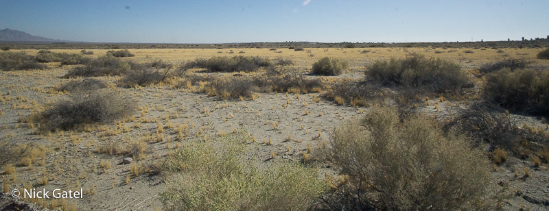
The entire horizon in the picture below is just a small section of the Dos Palmas Oases, just to give an idea how expansive and full the area is with palm trees.
The area of palms is immense, and includes several small ponds, some that might even be called lakes. It is indeed an oasis with desert pupfish, ducks, birds, mammals, and reptiles — a striking offset with the apparent stark desert surrounding the oases — but to desert dwellers like me nothing in the desert is stark or empty.
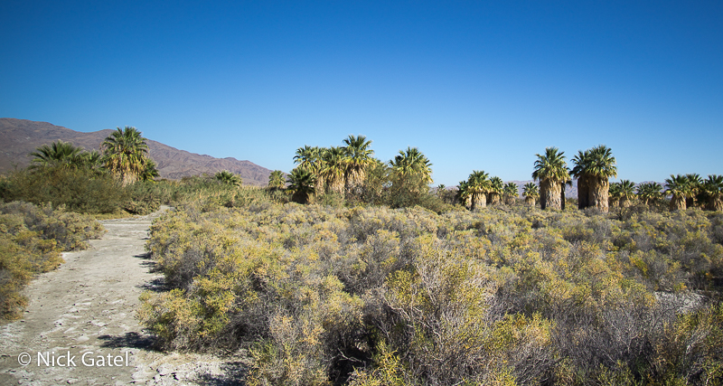
In the picture below I am approaching the first stand of palm trees in Dos Palmas. Look closely at the trail and notice the white alkaline surface. This is what makes the Salton Sea so saline over time. Centuries ago the Salton Sea covered this area too. The election at this spot is 109 feet below sea level, about 136 feet higher than the current surface of the Salton Sea and more than two miles from the current edge of this lake.
Click a picture to see a full size image from the Dos Palmas Oases:
Some of my other posts about Palm Oases:

