An Appalachian Trail section-hike through Maryland.
PERCEPTION
If, like me, you have lived most of your life in California, have hiked its expansive deserts or walked throughout the granite spires of the High Sierra, and really don’t have a good grasp for the minute nuances of the geography on the east coast of the US, you might be impressed if I told I just completed a thru-hike of the Maryland section of the Appalachian Trail (AT).
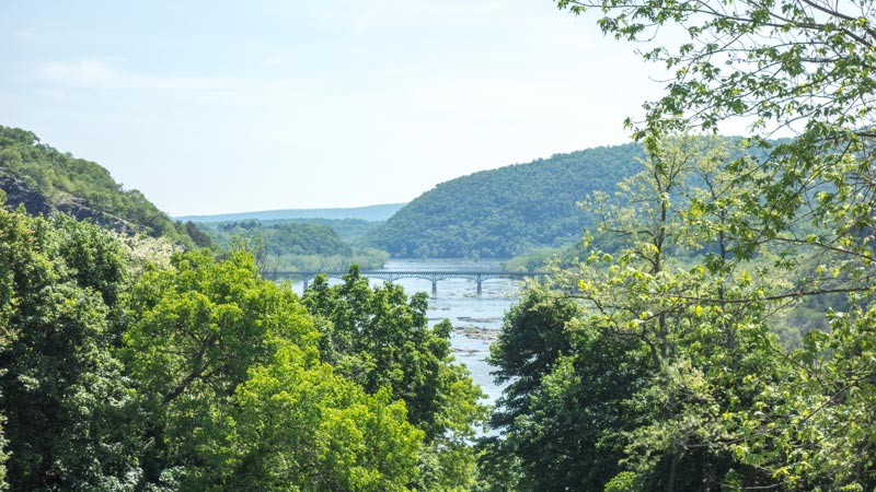
If one hikes the AT from south to north, you would enter Maryland from Harper’s Ferry, West Virginia crossing the bridge spanning the Potomac River. From here you would head north generally following the crest of the South Mountain Range, eventually crossing the Mason Dixon Line into Pennsylvania.
REALITY
The 2,000+ miles of the AT starts in Georgia and ends in Maine. Harper’s Ferry is almost the mid-point of the trail, and is also the home of the Appalachian Trail Conservancy, which administers the AT. I didn’t know this until this week, where I found myself in Maryland looking for a place to hike.
This section of trail, runs through the west end of Maryland and is only 41 miles long. This side of the state is less than 40 miles long. A geography lesson for me!
I also learned that many AT thru-hikers attempt to do the Maryland section in one day, which they call the Maryland Challenge. I guess after hiking nearly 1,000 miles, many of these hikers are in good enough shape to do the one-day hike. I am not in that kind of physical condition. But doing it in one and a half days was realistic, since Maryland is one of the gentlest sections of the trail with little elevation gain and loss. For me to do it it 1.5 days would require an extremely light pack and good weather. The weather was perfect – spring weather that had mild days and moderate night time low temperatures.
LOGISTICS
About 1.5 miles from the town of Harper’s Ferry is the visitors center parking lot for Harper’s Ferry National Historic Park, a secure place to leave a vehicle, and free entrance for me using my National Parks Pass.
Parking at the north end in Pennsylvania was not a secure place, apparently a vacant place about a mile from the trailhead. Getting a ride back to Harper’s Ferry was an easy hitch; people in the area are used to giving rides to thru-hikers.
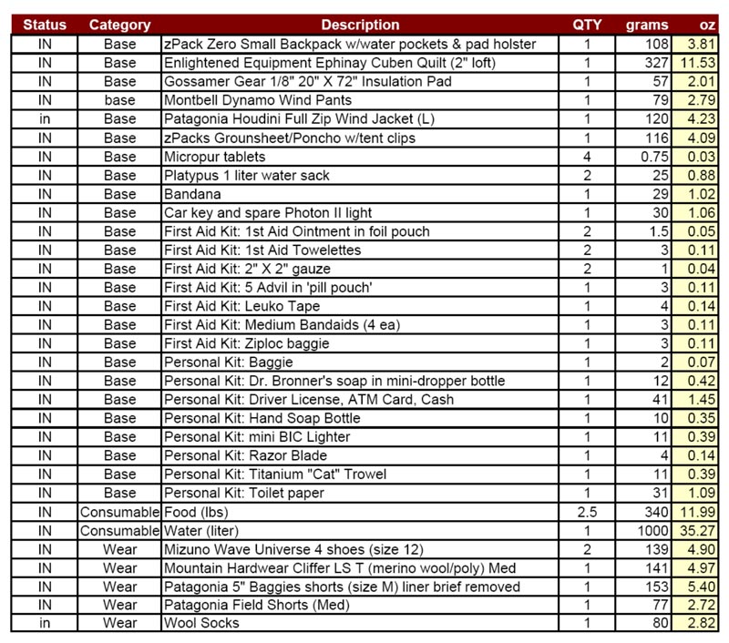
To keep pack weight down, little gear was taken or needed. No stove, and no extra clothes other than a wind shirt and wind pants. Being that this area of Maryland is rich in history, especially important Civil War battlefields, a camera would have been a particularly heavy piece of equipment as I would have not been able the resist the time consuming temptation of stopping to take pictures – so it stayed in the car.

Harper’s Ferry is located on a point at the confluence of the Shenandoah and Potomac Rivers. I walked from the Visitor’s Center along the Shenandoah to Harper’s Ferry, then across a bridge spanning the Potomac. Just before Harper’s Ferry is another bridge that crosses the Shenandoah to the Virginia side of the river. One could walk across into Virginia and turn back, thus saying they walked in 4 states. But what’s the point? I was just out for a hike, and it wasn’t any big accomplishment. Just a nice walk.
GEAR
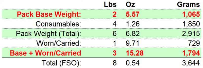
Over the past couple of years I rarely include a gear list for a backpacking trip. I’m including one for this trip, because gear taken was marginal allowing me to walk at a fast pace. The weather forecast was good, it was a short trip, there were many easy bail-out points, and the trail is well used. It is not a list I would recommend.


