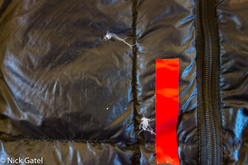
A common ailment for hikers are foot blisters, and I would imagine more backpacking trips are cut short due to blisters than any other cause.
Typically I want to use a product for at least 10 years before recommending it. Leukotape not only meets this standard but it is an amazing product – the best I have ever used for preventing and treating blisters.
For most people, myself included, the primary function of a compass is a simple “field check,” which is orienting the map to North using your compass and then visually associating the terrain to the map. Basically you know where you are, but you need to check details for such things as deciding if is best to hike to the left of a large rock outcropping or right when you are off trail or the trail has become too faint to follow.
I’ve been cheating. Actually I’ve been cheating for a long time. You see, for decades I’ve been taking the Palm Springs Aerial Tramway up to the mountains; mostly in the summer and winter. I do it so often; I have an annual pass, which currently costs $160 per year.
San Jacinto Mountains
This mountain range is about 30 miles long and is in close proximity to the San Bernardino Mountains and Santa Rosa Mountains (a.k.a. you can walk to either range from the San Jacinto’s). Much of the area is designated State and Federal Wilderness Areas.
Mt. San Jacinto escarpment
The crown jewel of this range is Mt. San Jacinto, which rises more than 10,000 feet from the desert floor making it one of (if not the most) steepest escarpments in the continental United States.