Back in 2013 I wrote about finding remote campsites in this article, Boondocking.
My methodology hasn’t changed much. In this post I’ll share some of the tools I use and a few tips.
I will copy some of the text of the original post above, because, well, I’m lazy. The first order of business is to define my version of boondocking, which can also be called dispersed camping. That is, camping at undeveloped sites. I look for places that are:
- Not known to many other people
- Remote so it is unlikely that someone will even drive by your site
- Free is preferred (although I don’t mind paying)
- Quiet
- Great views
- Remote so it is unlikely that someone will even drive by your site (just want to emphasize this)
Current State of Affairs
The biggest obstacle to finding a nice remote campsite is the Internet. The number of people sharing information on where many gems of remote camping are located seems to be growing at an exponential rate each year. So, as I normally do, I will not share any specific details of places we camp at. Things are deteriorating as it is.
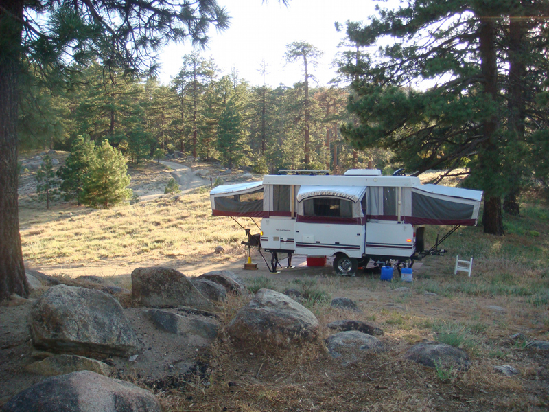
For example, when I wrote the Boondocking article back in 2013, I had been camping in a little known area of the San Bernardino National Forest for decades that always saw limited traffic. We could arrive on the Friday night of a three-day weekend (i.e., Memorial Day, Fourth of July, Labor Day, etc.) and find several open sites. Nice sites!
This area is along a 12 mile dirt road and there are 11 designated dispersed camping sites, which are the only spots where one can legally camp with a vehicle. We stopped camping in the area at the end of 2013 when we bought our Milan 26RLS, because the trailer is too big to drive on the road due to low hanging tree branches.
Shock (not really) & Disappointment (yes, really)
Fast forward to Memorial Day weekend 2020. I hiked through the area on a backpacking trip. Not only was every site taken, some sites had up to six vehicles where the maximum allowed is two. Because all the sites were taken, several morons, idiots if you please, had driven their vehicles onto pristine meadows to set up camp. Adding insult to the stereotypical idiot, some of these morons where cutting down small trees for firewood. I actually cut my trip short by a day so I could drive 20 miles out of my way to the local ranger station to report the problem.
Social Media and the Internet Sucks
This is why I am mostly critical about the Internet and social media. Neither are inherently bad, there are simply too many stupid people using them, and they find great camping sites via these tools, which often become not so great sites after said morons liter, degrade and sometimes burn them down.
Agencies Administrating Dispersed Camping Areas
It should be pointed out that the greatest abundance of dispersed camping areas in the US are mostly in the Western, Southwest parts of the country, which is where I camp and backpack most of the time. Alaska also has an incredible amount of opportunities, but it is the only state I have not visited (yet).
Keep in mind that each agency’s area or district may have different rules. So do your research before you head out to a destination. We camp in areas administered by all these agencies.
Many districts have hundreds and in some cases thousands of miles of roads in the back country.
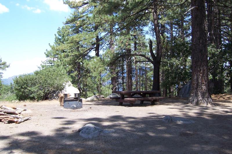
Almost without exception, dispersed camping sites will not have water available, any kind of toilet, picnic tables, fire rings, or trash cans. It is important that you take your trash home with you and leave your site better than you found it.
If due diligences isn’t exercised by everyone, the area might be closed to camping by the agency in charge. An example is an area in the Sequoia National Forest. I used to camp there often in the ’70s and ’80s until the pigs (people) began to mess it up. Joyce I drove by the area three years ago on a trip and the entire area (quite large in fact) was completely closed to any activity including hiking or fishing. It is sad, because a nice stream, which was often good trout fishing, runs through the camping area. Large signs were posted stating the area was closed due to misuse by campers.
In areas where bears are present, you must take appropriate steps to protect the bears (e.g., protect your food and don’t leave trash out).
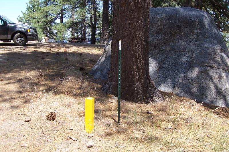
The San Bernardino National Forest designates dispersed sites with a Yellow post and most do have a metal fire ring and picnic table. A few other agencies have similar “amenities.”
National Park Service (NPS)
The NPS has several designations for lands under their control, such as:
- National Parks
- National Monuments
- National Preserves
- National Recreational Areas
US Forest Service (USFS)
Again, regulations vary from unit to unit. What may be permissible in the Coconino National Forest may not be allowed in the Inyo National Forest, and visa versa.
Bureau of Land Management (BLM)
This agency is larger than many people know, managing 10% of all the land in the United States. There are many, many dispersed camping opportunities on BLM land.
State Agencies
In California there are some state parks that allow dispersed camping. An example is Anza Borrego State Park.
All these agencies publish maps. Up-to-date information, rules and regulations are published on their respective websites, although sometimes it isn’t easy to drill down through the pages and find the information you might need.
Tools for Finding a Great Remote Campsite
The Internet
I mostly use the Internet to eliminate potential places to visit. If there are a lot of trip reports, articles, or God forbid, a published camping guide, I avoid them.
However, the Internet is the place to research an agency’s rules and regulations, and to get up-to-date alerts that may make travel prohibitive.
Before continuing with the “tools of the trade,” I should preface this with the fact that almost all remote, dispersed camping spots are only accessible via dirt roads. Some roads are fine for small two-wheel drive vehicles.
I have made a couple trips to a very remote primitive campground in the Trinity Alps with friends. Our destination requires a thirty of forty mile drive on dirt roads and my friend Peter was easily able to navigate the drive with his tiny Toyota Yaris. Often main dirt road corridors are periodically maintained with road graders and other heavy equipment.
On the other hand, many, if not most, back country roads require high clearance 4WD vehicles. It is not uncommon for roads to be washed out during storms and maintenance may or may not ever happen. To find these roads you will need a map.
Maps
Back to that Boondocking article I wrote in 2013, I stated:
“Get a big-ass road atlas. A map of the entire state is preferred. Now look for large areas of land that have few roads on it. And if the road is designated “unpaved” that is a good sign!
“Now start drilling down to the large portions of vacant public land. The Internet is helpful. Your best bet are lands that are managed by the Federal Government such as the National Forest Service (NFS), National Park Service (NPS), and the Bureau of Land Management (BLM). Often you can view maps online, but it is better to contact the agency and purchase a paper map. Many maps will indicate how the land is designated for use. For example, you cannot drive in designated wilderness areas.
“Now that you have located an area you want to go, study the rules and regulations for the area. Typically, if there is a charge for a specific camping site, then there are going to be people there when you arrive — bad idea. Some areas will be designated as dispersed camping areas — that is good!
Some Tips
The further you are from a large city, the better. The further you are from a small town, even better. Large rivers and lakes attract people, just like people attract mosquitoes and flies.
A lack of cell phone service is to be expected and is desirable.
If fire restrictions are in place (no campfires or portable stoves) that is even better because a good number of people will skip camping.
What you are looking for are the lack of amenities that most people seem to think are requisite for a wonderful outdoor experience.
Road Atlases
These should be your first level tools. They have everything you need for planning, are portable (remember you are looking for places without people or Internet access), and are large enough to see much detail.
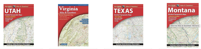
The best two in my experience are made by Benchmark and Delorme.
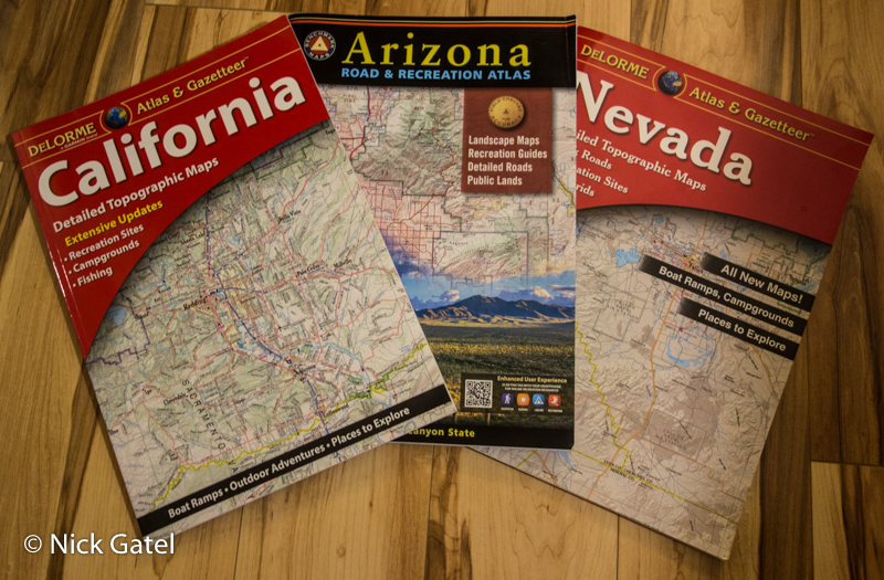
Delorme Altases
![]()
Both are good.
If you want a review of both atlases with pro and cons of each, visit my friend Paul’s blog (PMags) to read his review, Backcountry road map guide: Benchmark vs Delorme (link below).
Agency Maps
I always get a map produced by the agency administering the area I am visiting (I have a large collection now).
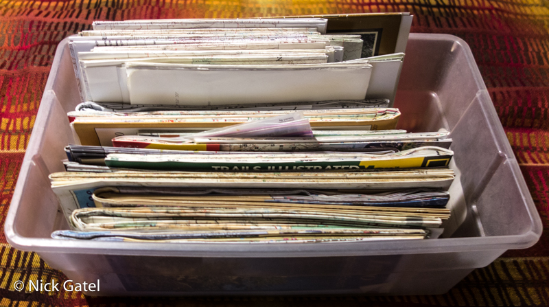
These are often more detailed than the state Atlases by Benchmark and Delorme.
Some agencies produce motor vehicle maps that show all the roads in their jurisdiction including small and obscure dirt roads.
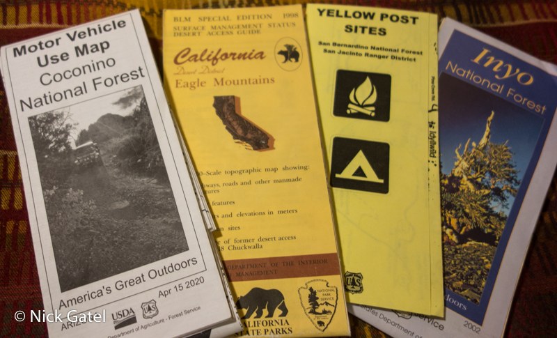
Below are four different maps (left to right)
- Coconino National Forest (Arizona) Motor Vehicle Use Map
- Bureau of Land Management Map of the Eagle Mountains area (southern California)
- San Bernardino National Forest, San Jacinto Ranger District (California) Dispersed Camping Sites (this is actually a folded 8.5” X 11” hand drawn map)
- Inyo National Forest (California) Area Map (includes trails and all dirt roads)
USGS Topographic Maps
I recommend you do not use these maps for back road navigation. The roads on the maps are often outdated and inaccurate. These maps are my go-to source for backpacking, but I never use (or trust) them for road travel. The same goes for GPS units. For example, Joshua Tree National Park warns visitors not to use GPS for this very reason.
The exception is when one of the other maps show roads I think might be in difficult terrain. If the road is on a USGS topographical map, it may give me a better idea of the terrain and possible challenges.
Can I Get There?
One should plan ahead to try and match the roads to the kind of vehicle you will be driving, plus the more difficult to figure out scenario when or if you are towing a trailer.
As mentioned earlier, maps of dirt roads often do not (and cannot) reflect current conditions. Check the agency’s website to see if there are any alerts of current condition information.
It isn’t a bad idea to call the local ranger station or stop by in person for road conditions at the start of your trip.
Towing trailers can pose difficulties, especially if the road is in poor condition and you need to turn around. Keep in mind that dirt roads are often single lane affairs.
Case Study #1
Last summer we wanted to explore parts of Northern Arizona. Although I have backpacked sections of Northern Arizona, car or trailer camping is a different animal.
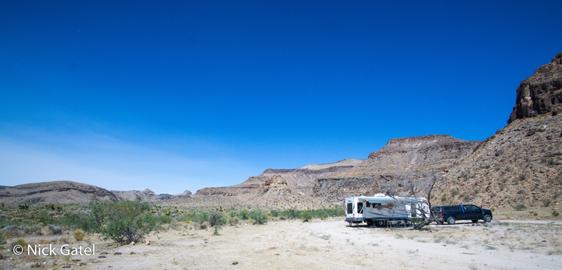
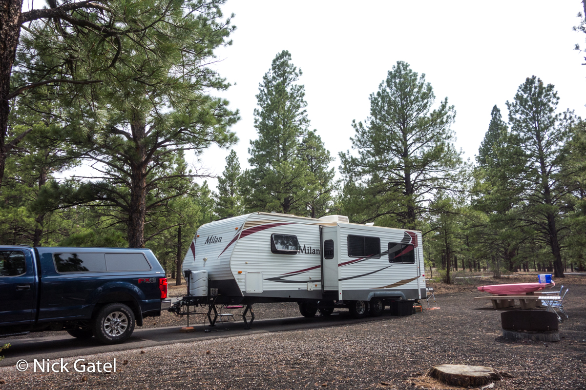
We have 26 foot camper (30 feet long hitch to bumper) and tow it with a Ford F-250 Super Duty Truck with a crew cab and a long (8 foot) bed. Although the truck has 4WD, the combination is sooo loooong. This can present problems making sharp turns on single lane dirt road or driving past very steep dips in the road, such as where a creek bed crosses the road.
With this configuration, our trip to Arizona was to be an exploratory trip of sorts — no dispersed camping. We planned to camp in a developed USFS campground, then explore the area’s dirt roads and dispersed camping opportunities for future reference.
Road Atlas
So I started with my “big-ass” road atlas of the entire state of Arizona (map below has been cropped to fit).
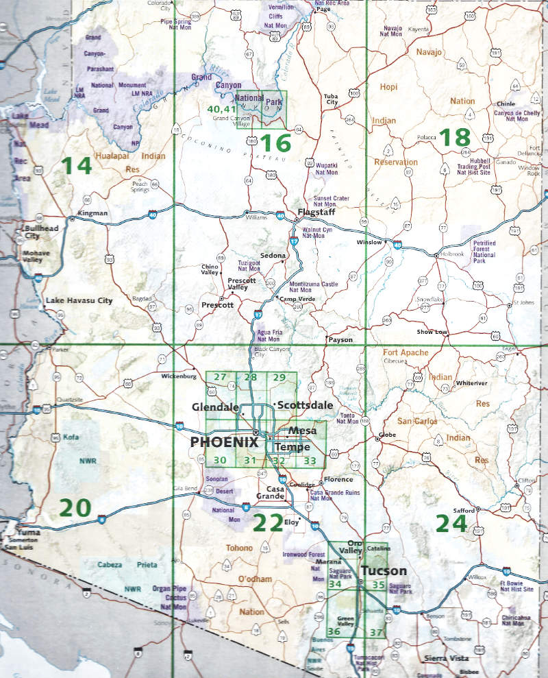
Note that the area north of Flagstaff (near center of area 16) is pretty much devoid of cities — a great thing to find!!
Further back in the atlas is a page with just section 16. I have cropped it so it is easier to see the USFS dirt roads (see below). The Forest Service roads are marked with a rectangle around the road number.
The legend at the bottom of the page shows what kind of a dirt road it is by its shape or configuration (double lines, thick lines, thin lines, etc.), which is pretty handy.
The question one might ask, “Is there a better map?”
Yes there is!!
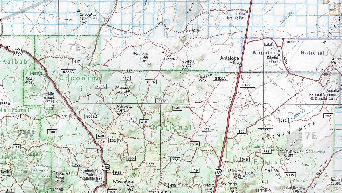
USFS Map
The “Coconino National Forest Motor Vehicle Use” map is much more detailed (see below). I cropped a section of the map so it would show better on the website. I knew ahead of time the map was available and bought it at one of the Government visitor centers in the area. I did not check to see if it could be purchased online or by mail.
Take a look at Roads 418, 514, and 773 (above). Do you see all the “dots?” Those dots are areas you can camp for free, with a 14 day limit at each site. Fabulous!
Some of the larger dirt roads that have a solid double line are periodically graded and we found most of them easily navigable. However one such road had severe damage from flooding and was a boulder-fest — maybe passable with our truck alone — impossible had we been towing our trailer.
Most USFS maps have similar detail of roads, although they are not specifically laid out for just “road use.”
This part of the trip was a success. We located many places we will like to return to camp, plus we enjoyed the sightseeing. However, the trip really drove home the point of surveying roads before hauling a trailer on an unknown dirt road.
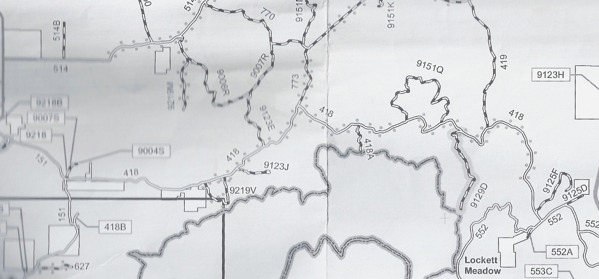
Disaster Strikes
We drove on some other roads north of the those on the map above, and the condition of some roads, with similar legends, wasn’t so peachy-keen. One road, on a slight rise, gave out and our truck slid into an embankment with the tires in a ditch, ripping off one of our floorboards. A recent rain had undermined the road, which wasn’t visible while driving.
We got out of a ditch without too much difficulty and there was no other damage.
I was surprised my door wasn’t damaged as it appeared the truck, at first, was leaning against the embankment. Turning around was a little tricky. Had we been towing the trailer, we would probably still be there today 🙁
The bad news is the factory floorboards are exorbitantly expensive. So I bought a pair of aftermarket boards when we got home.
Case Study #2
This happened this summer also, on a trip to the Eastern Sierra Nevada.
In preparation for the trip, I did an Internet search — not to find a spot — but to gauge how busy the area might be. I found that nearly every developed campground in the Eastern Sierra, that accepted reservations, was pretty much filled to capacity every single day from mid June until Labor Day. A phenomenon that also occurred in 2020, which was driven, in great part, by the COVID pandemic. But I wasn’t looking to make a reservation at campground.
Our plan was to camp somewhere in the Inyo National Forest, an area I know like the back of my hand. My concern was people flooding into the dispersed areas, due to all the full campgrounds and a lot of information about the dispersed camping areas now posted online. In case the dispersed areas might be overrun with homo sapiens, we would just go further north. However, driving from Palm Springs to the Inyo National Forest is far enough for a day’s drive towing a trailer.
So I brought my California Atlas and a few other USFS maps of other areas.
As I suspected, my favorite dispersed sites were somewhat crowded. There were some spots, not the really nice ones, that were empty.
Another option in the Inyo National Forest are a couple large undeveloped campgrounds that offer free camping. No water, but they do have pit toilets. Most have well maintained dirt roads. What the heck, might as well check out the one I know well . . .

Hells, Bells, the campground was about 30% full and didn’t get crowded on the weekends either. We found a great spot at the back of the campground away from all the people, and enjoyed a great two weeks.
It just goes to show you can’t anticipate what may happen. Plan ahead, bring your maps, and have an alternative plan!
This website may be compensated for linking to other sites for sales of products. As an Amazon Associate I earn a small fee from qualifying purchases at no additional cost to the purchaser.