After spending a day with my wife after the December Anza Borrego Trip, I decided to head to Nevada to do a 3-day backpacking trip in the Muddy Mountains Wilderness. The boss said I had to come back by Christmas Eve and be available for Christmas. That sounded fair enough.
The weather forecast was better than what I had just experienced in Southern California, so switched out the Trailstar for my Hexamid shelter. All other gear remained the same, for simplicity and because it would be perfect for this trip as well.
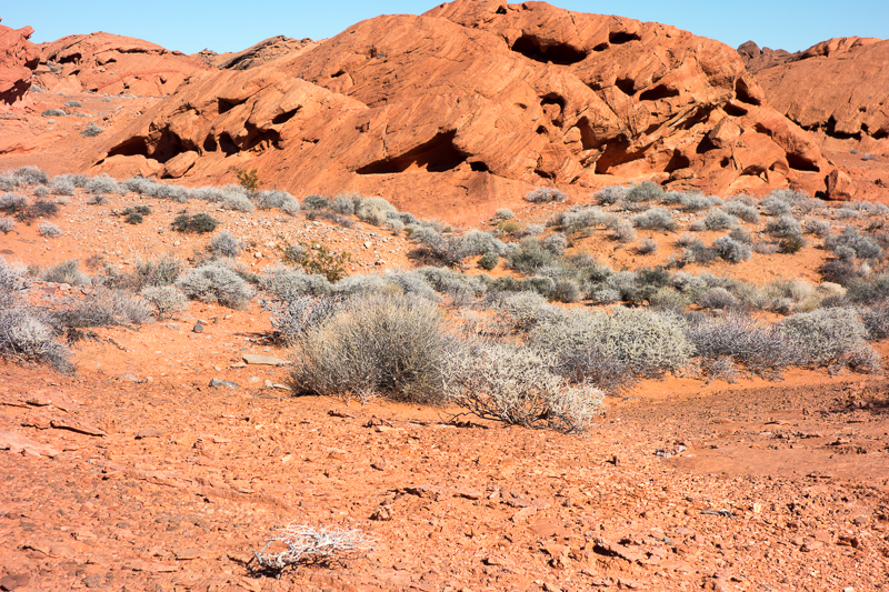
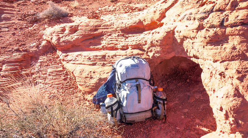
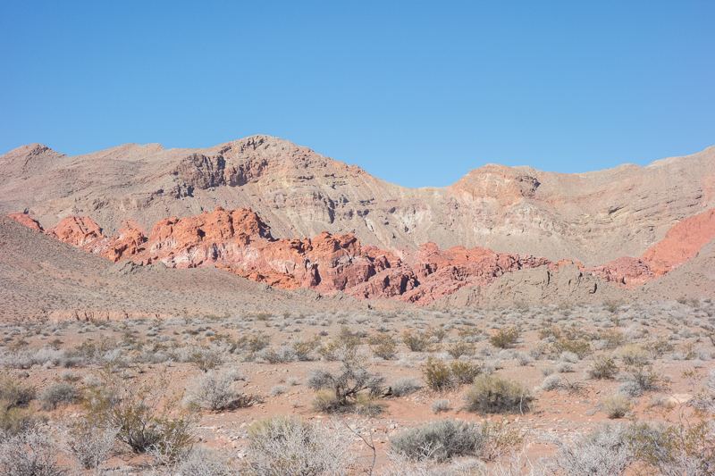
I have spent quite a bit of time in the Muddy Mountains, so part of the trip would be an encore and another part would be exploration of parts new to me. I had a fully charged battery in the camera, new AAA’s in the headlamp, and again took my solar Casio watch. There was no time to replace the battery in the Timex Expedition. Also, as I did on my last trip, I did not bring a map. It is pretty easy to get “unlost” in this area. All major washes flow all the way to Lake Mead. So follow any major wash and you will end up at the main road through the northern section of Lake Mead Recreation Area. There is a certain sharpness of mind that is created when you know you do not have a map to reference.
I am not inclined to write another comprehensive trip report, so this will be more of a pictorial tour.
DAY 1
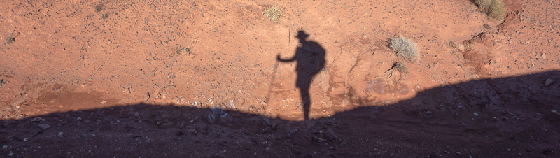
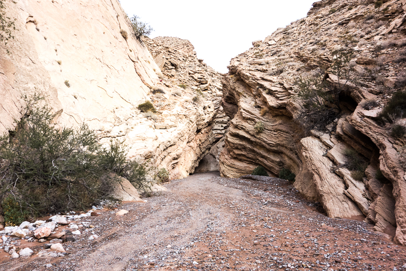
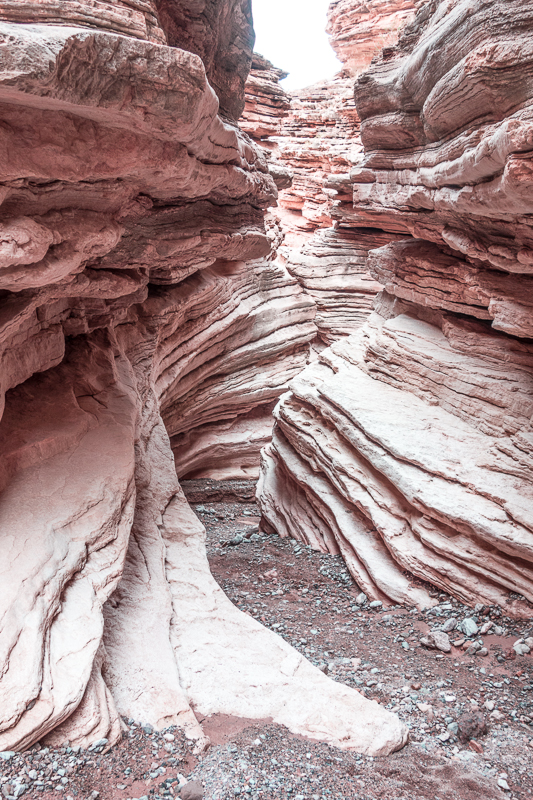
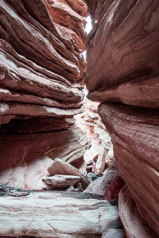
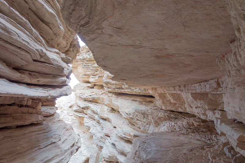
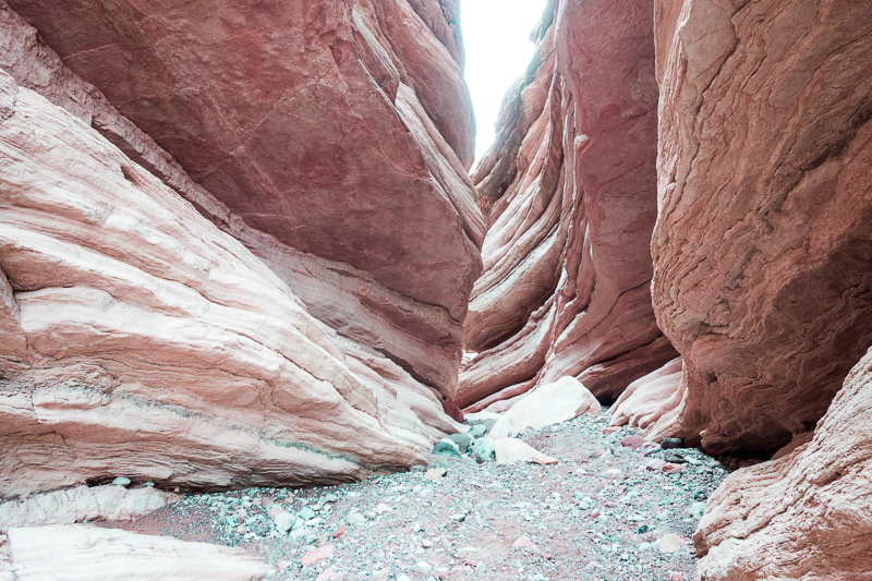
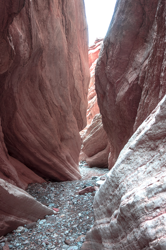
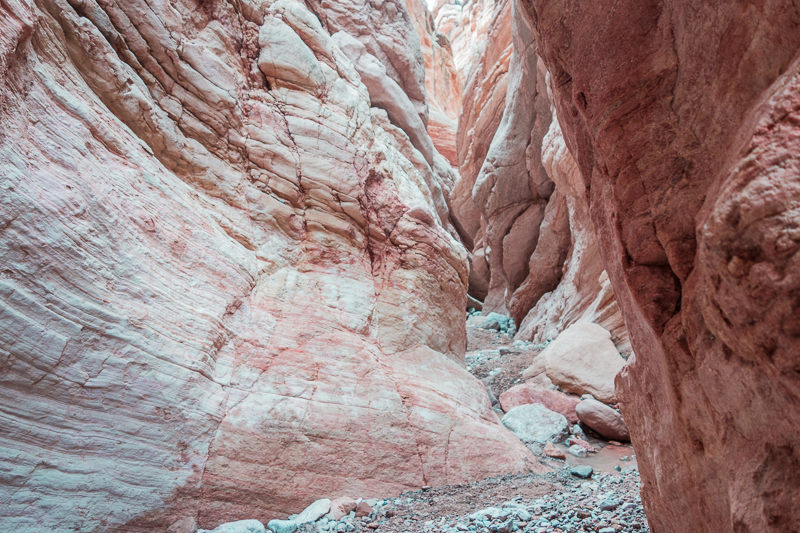
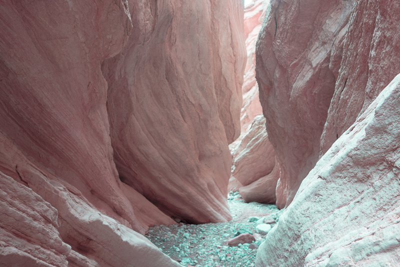
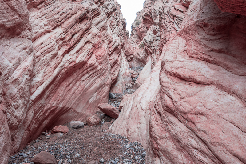
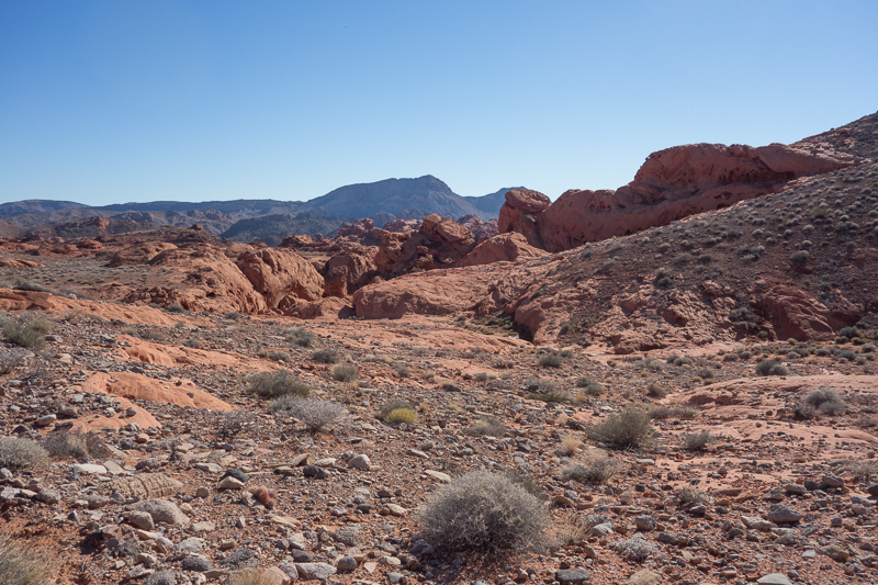
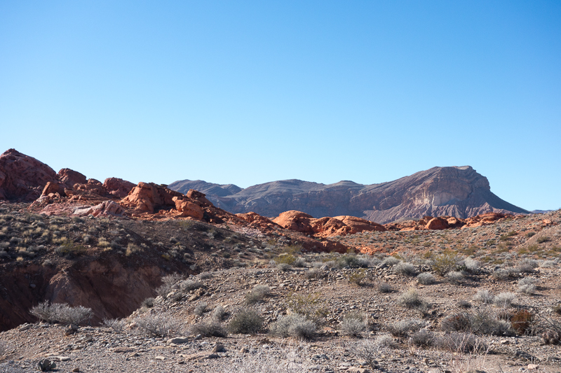
After Joyce dropped me off, I headed towards Lovell Wash, which would bring me to the first visual treat – a slot canyon named Anniversary Narrows. I noticed that mining in the area has resumed and was quite surprised that an elevated dirt road had been built across the wash causing a large muddy puddle to form behind the dirt berm that now acts as a road. I guess the mining company must have rights to this area, as upstream of this new road is the Wilderness boundary border marker.
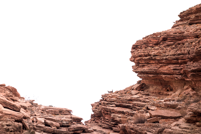
Once I entered the canyon I spotted 3 big horn ewes high above the canyon.
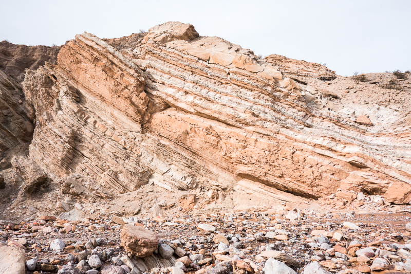
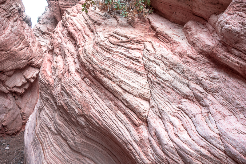
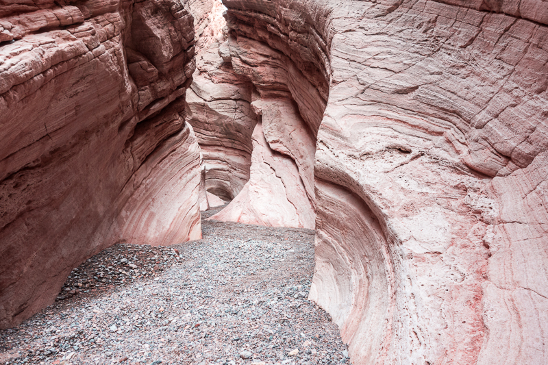
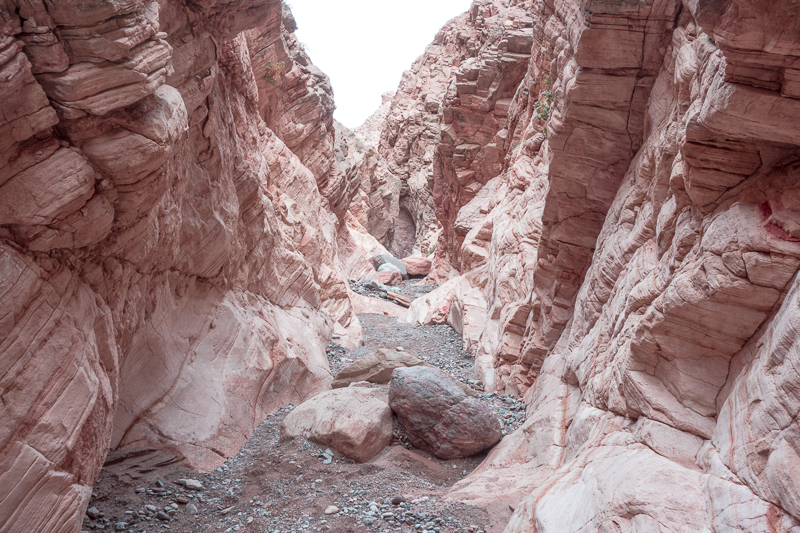
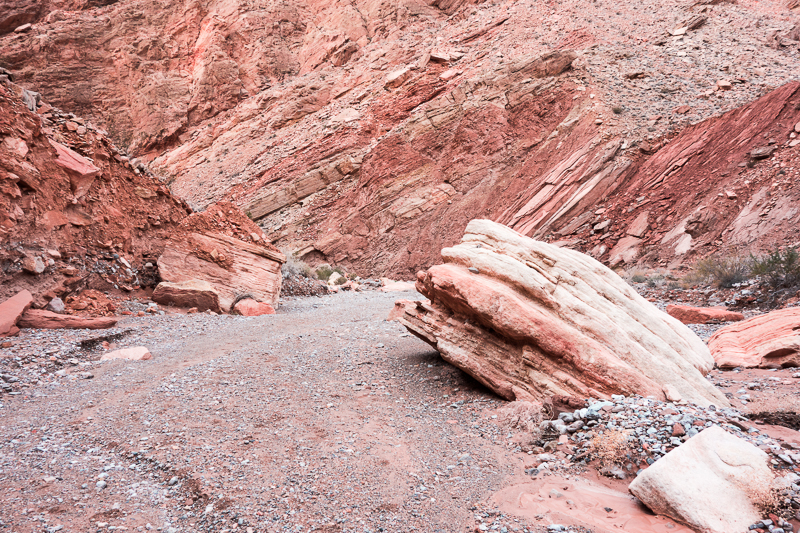
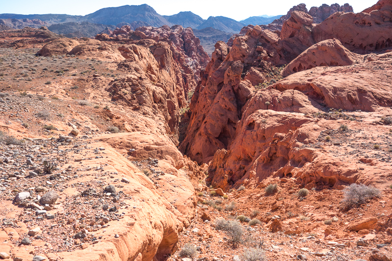
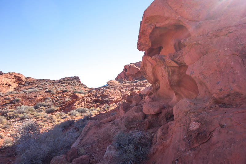
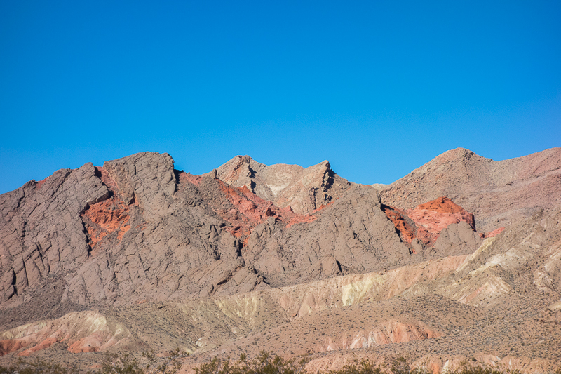
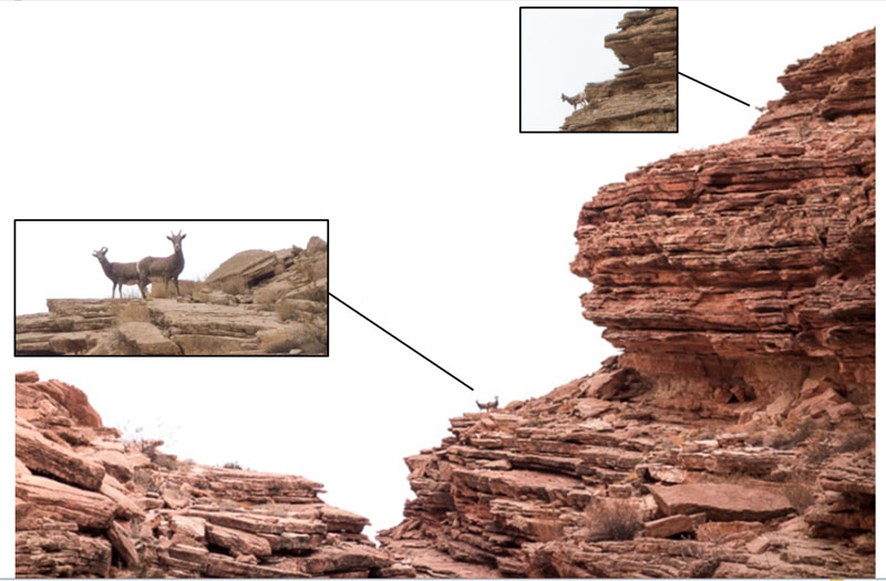 The colored sandstone walls and aqua blue gypsum rocks give this area a colorful eye candy treat.
Exiting the slot canyon my goal was to hike all of Lovell Wash as far as possible and get close to its source in the Muddy Mountains. This is one of my backpacking quirks: trying to hike to the source of streams, creeks, and washes. A few minutes after leaving the slot, I saw a few people in a side wash. These were the last people I would see for three days.

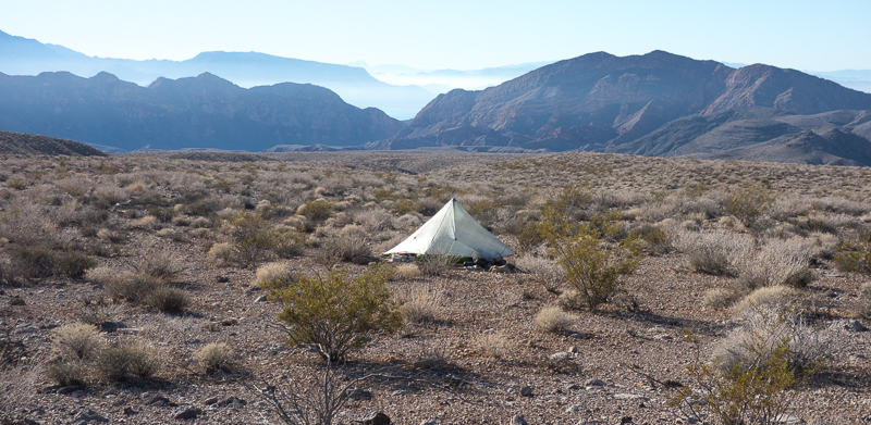
 After wandering around the upper reaches of the wash where it became too difficult to travel further, I headed up to a plateau to find a suitable night camp. Although the area is exposed and possible windy, the view would be worthwhile. Fortunately I oriented my shelter to protect me from the night winds, which were mild at their worst.
One thing about the soil in this area is that with all the recent rain, the ground is soft like a sponge with small rocks intermixed. It didn’t take long to clear out a smooth spot for my bed.
DAY 2
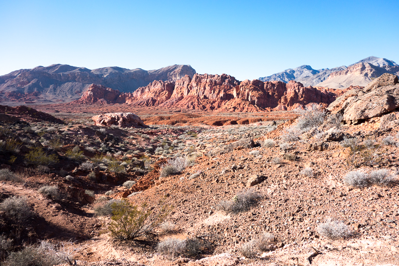
The plan for Day 2 was to head east towards Callville Wash and hike along this drainage until I could enter the Bowl of Fire. At this place, Callville wash is just a small desert wash. I would travel in and along this wash, on and off, during the next two days; it would grow wider and deeper as I progressed, due to eons of flooding, some very powerful at times.
I knew the north end of the Bowl of Fire would be difficult to enter due to the elevation drop into the bowl. I would figure out my options as I went.
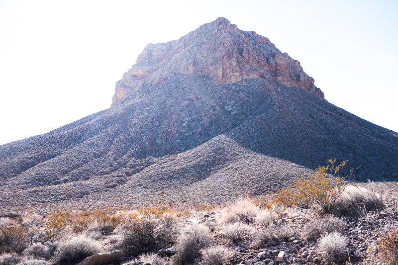
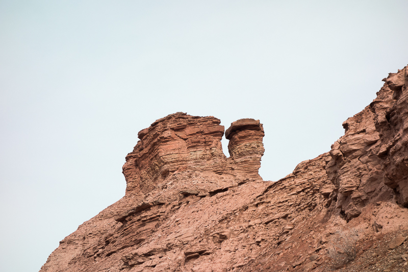
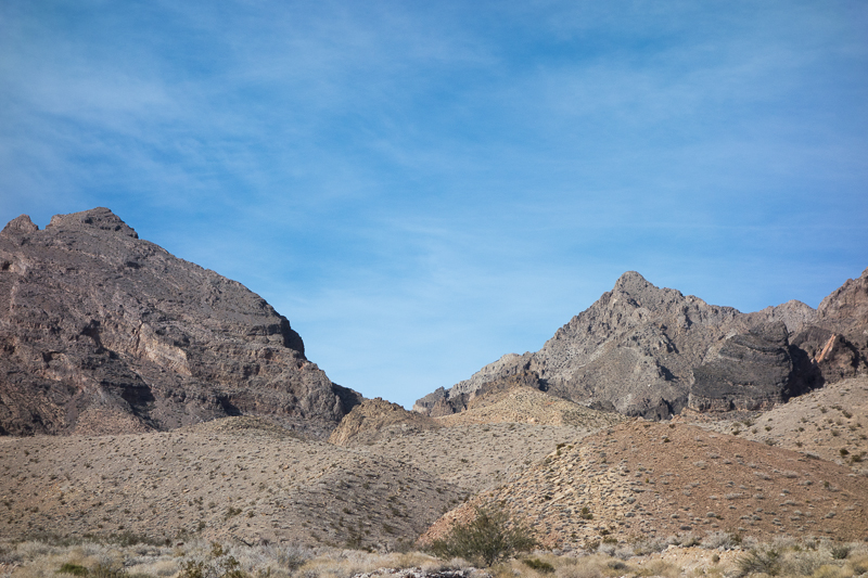
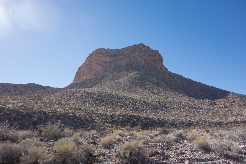
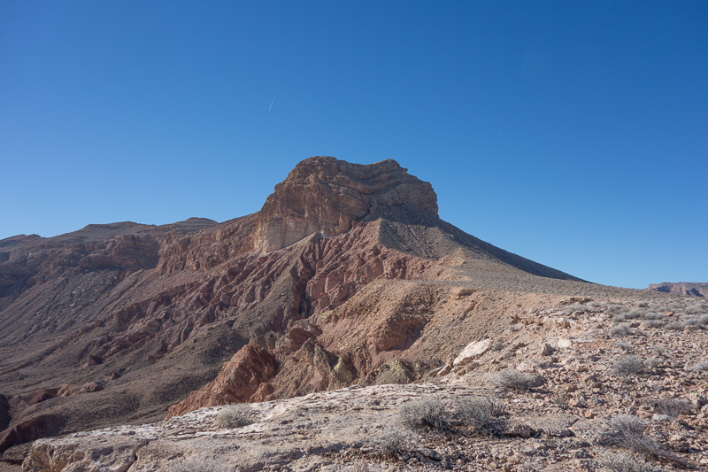
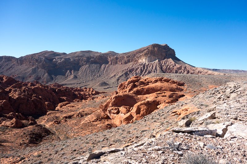
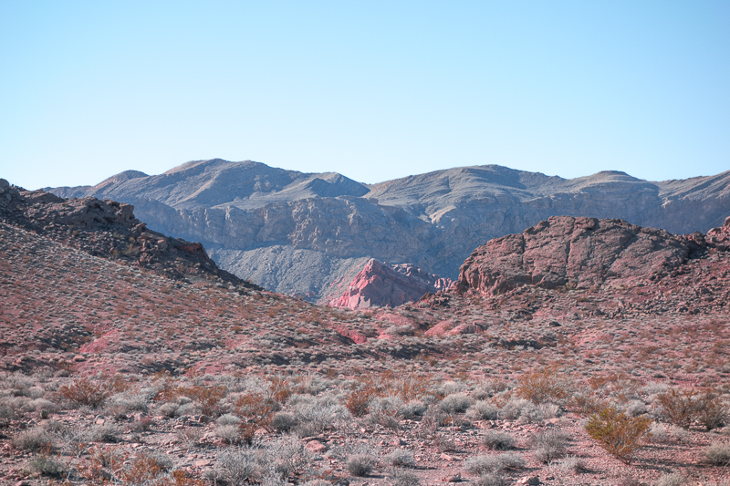
The above peak would be the prominent landmark as I traveled east and then southeast.
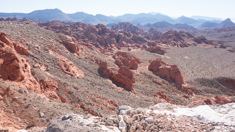
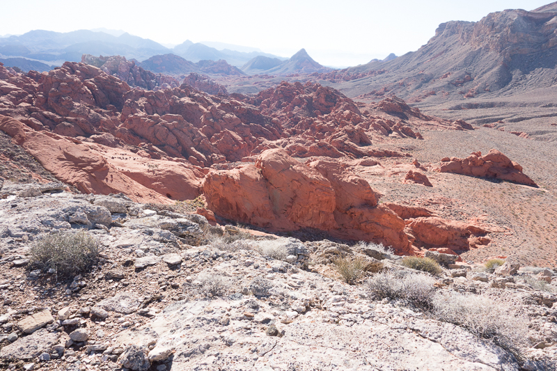
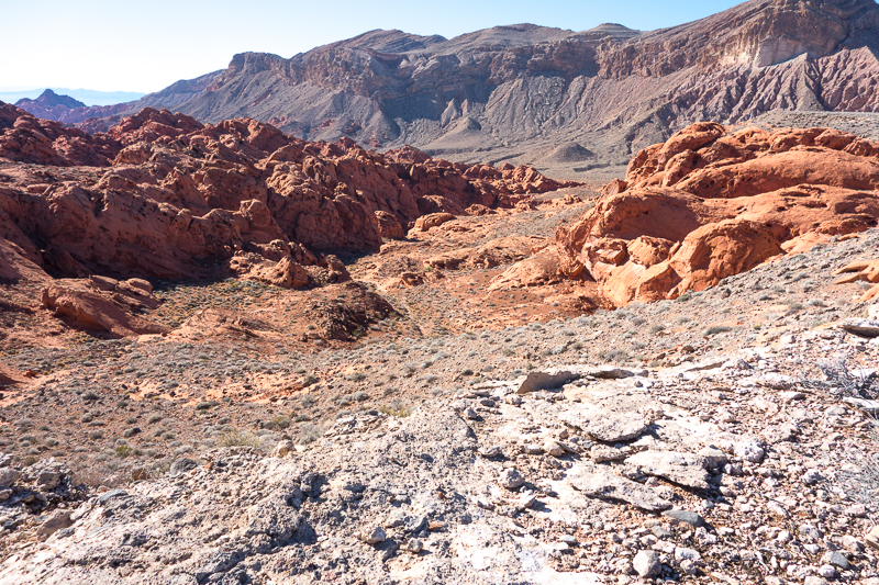
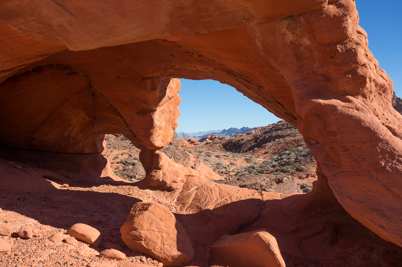
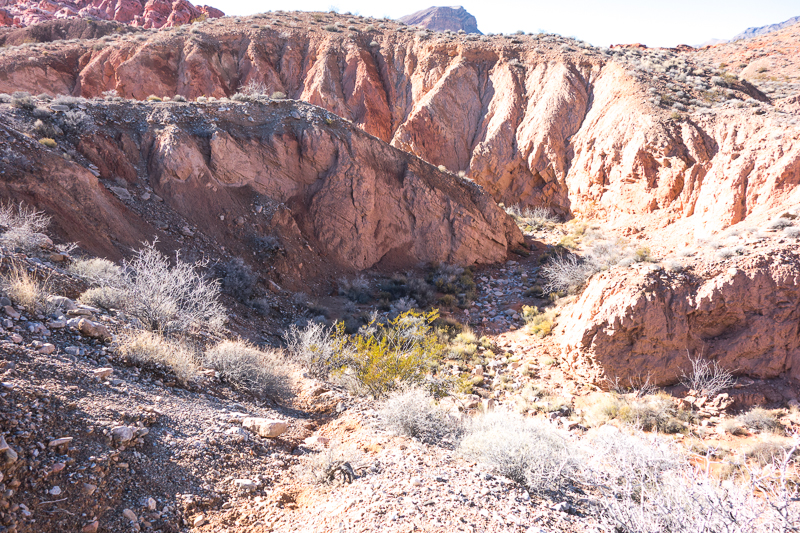
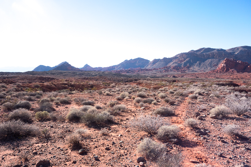
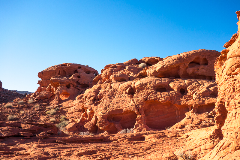
After a while, Callville Wash had cut a swath about 20 feet high in the side of a long hill that was another 80 feet or so high. I figured I was now close to the north end of the Bowl of Fire, and decided to climb the 100 feet or so to take look. Below is a picture looking west from my new vantage point.
Looking south from the same point, an amphitheater of red spread out before me.
My first thought was to find a route down into the bowl. The second thought was to circumnavigate the rim of the bowl and find an easier route in, while enjoying the varied views along the way. After a short contemplation of both options, the second was the obvious choice.
As I marched forward along the rim I found a slight footpath. It would disappear for 10 or 100 yards at a time, then reappear. Although I was not looking to follow this trail, I apparently was traveling the same direction as those who preceded me, as I kept finding this path. I knew my best bet was to eventually drop back down into Callville Wash, which originally was flowing east, but would turn south just outside the eastern side of the Bowl of Fire.

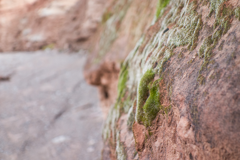
Yes, the plants are all colored an aquamarine bluish hue. I think this is from the minerals in the soil. Someday I will research it. It seems that the greasewood bushes are not subject to this coloring.
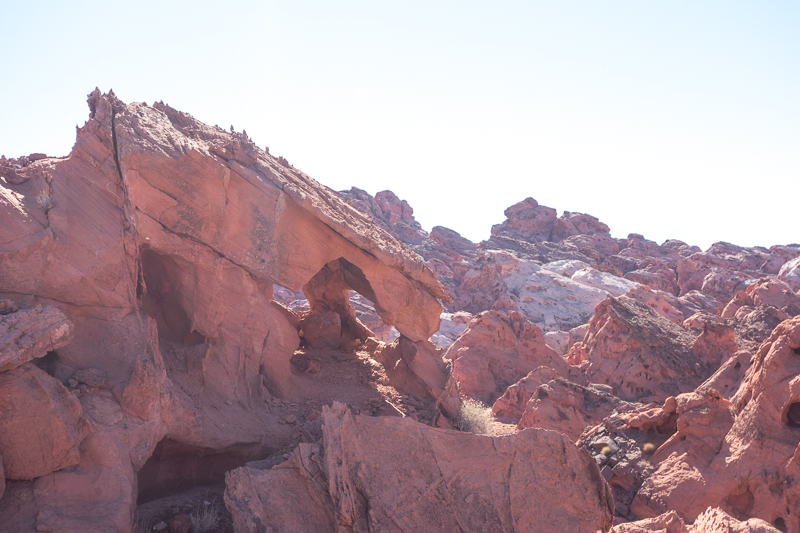

I was beginning to lose sight of the Bowl as I moved further southeast. At this point in time, I again picked up the trail and it led to small canyon. Not sure if this was an animal trail or man-made, but I decided to follow it down. I could always turn back if it didn’t work out.
This little canyon is about ½ mile long and easy to navigate. It opened up to Callville Wash. I was sure it was Callville because motor vehicles are allowed in the lower section of Callville and I was now walking on a well-worn vehicle track.
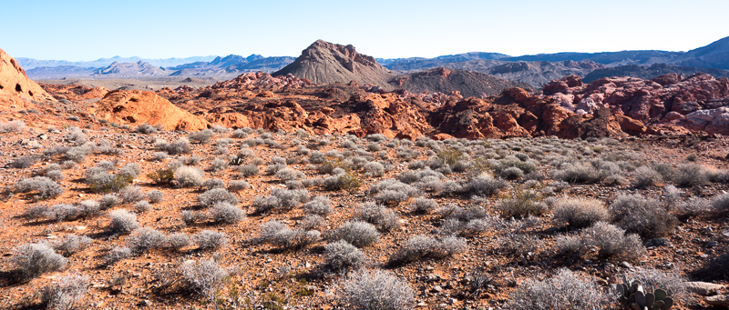
Next was to find a spot I could walk up out of the wash and then head west to the Bowl of Fire. Hopefully I would enter the bowl at the middle of its north to south limits.
This looked like a good spot to leave Callville Wash.
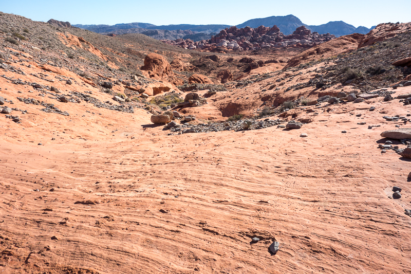
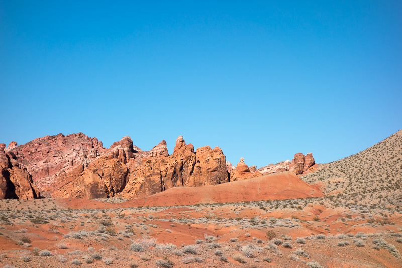
Once out of the wash there was a gap directly west showing the Bowl of Fire. There were a couple small ravines between me and the gap that looked like easy hiking. My only concern was that it might be difficult to drop down into the bowl from that gap.
View from the gap. An easy walk to the center of the Bowl of Fire!
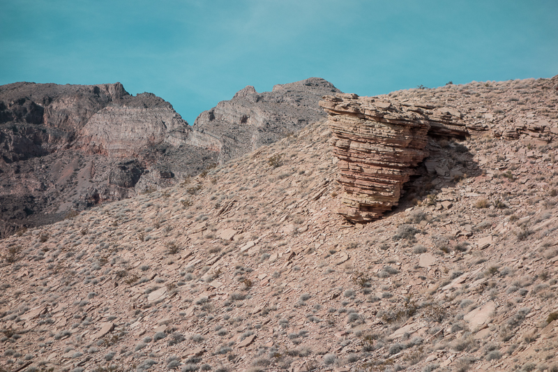
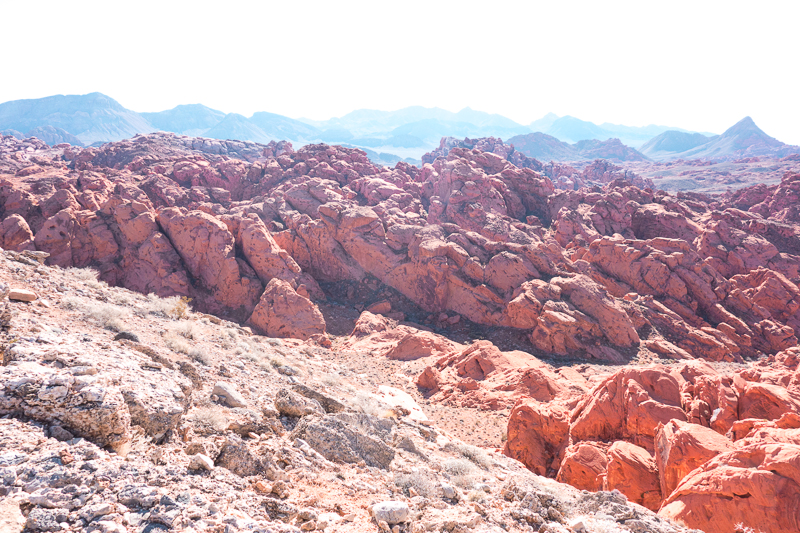
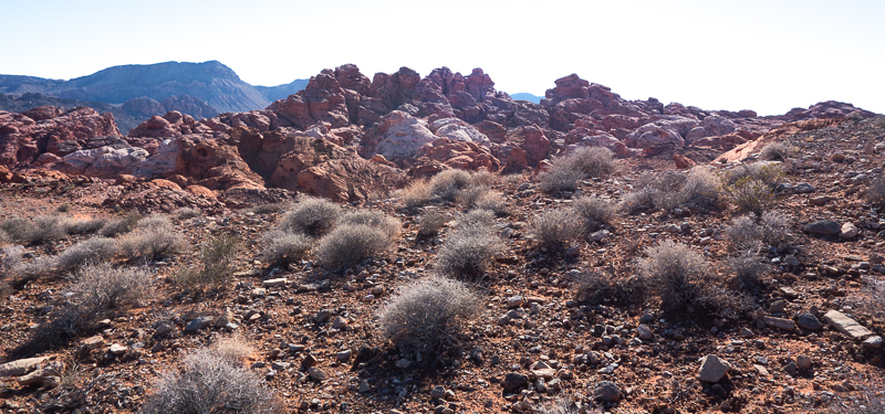
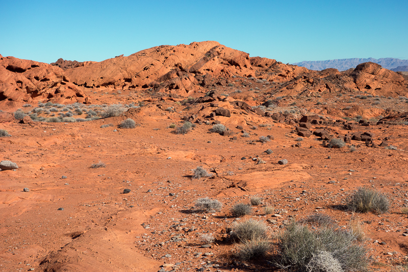
 I would spend the next 3 hours simply wandering around the sandstone formations. There were plenty of good spots to camp everywhere I looked. I decided I would stop at 4pm, which is about 30 minutes before sunset.
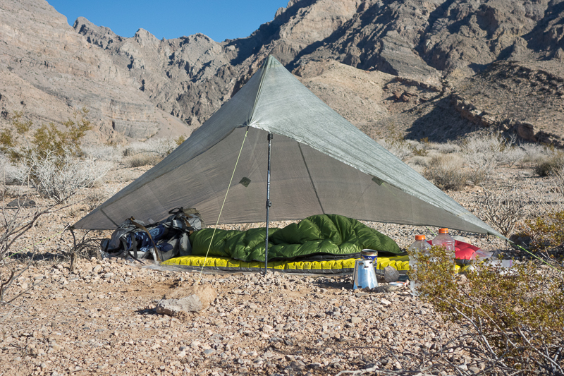
Finally good weather ahead. No need for a shelter.

Condensation
I thought I would share a little bit about condensation and sleeping bags/quilts. When we sleep our bodies evaporate moisture. This moisture along with the excess heat we generate will move up through the top of our sleeping bag or quilt. If the temperature, dew point, and barometric pressure are just right, this movement of heat and water vapor will condense into moisture on the top of our sleep setup. It doesn’t matter if you are in shelter, sleeping in a bivy sack over your sleeping bag or quilt, or just sleeping under the stars; condensation will form. Sometimes a shelter will minimize it and sometimes it makes things worse. Most of the time, if you can leave your bag outside in the morning sun, the condensation will quickly dry out. If you can’t do this and just stuff you sleep system into your pack, the insulation in the sleep system will probably get damp. Do this several days in a row and you have a wet insulation in your sleep system that will no longer keep you warm.
The reason I want to discuss this is because I woke up in the middle of the night and the top of my quilt had condensation on it. Just my quilt. No moisture on my pack or other gear that was outside. The heaviest condensation was at the foot of my quilt where the moisture had actually turned the color of the quilt material a dark green. From the foot of the quilt up to the head end of quilt the condensation decreased. This is because the top of the quilt near my neck is not sealed and some of the heat/vapor could escape. The bottom of the quilt is completely sealed so all the heat/moisture can only escape by migrating all of it through the sleep system. Of course, I was not worried because I knew the condensation would just lay on the top of the quilt and then dry out after the sun rose.
Some people think if they get up and cover their sleep system with something like a plastic ground sheet, which cannot breathe, they can stop this condensation. This won’t happen. The bag will still have condensation on it, but the top of the ground sheet will be dry! Now if one where to wrap the plastic ground sheet around their body and then get into the sleeping bag that will stop the condensation. It acts like a vapor barrier keeping the moisture inside the plastic sheet. But the body will still create water vapor and your body will get wet instead.
Anyway… the rest of the story. Shortly after discovering the condensation I just laid on my back and watched the stars and the occasional shooting star. Soon a light breeze began to blow, and surprisingly it was a warm breeze. Within 5 minutes the outside of my quilt was completely dry. Interesting stuff. With that I turned my attention back to the night sky. The next thing I knew it was 6am and the sun was rising.
DAY 3
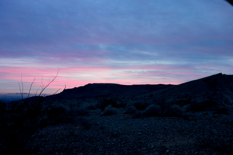
Most mornings in December in the high desert are cold. Usually in the 30’s (F) or colder. And I hate cold. I always try to situate my night camp in a location that will capture the early morning sun. Most winter mornings I play this little mind game. I watch the sun as it starts to hit things around mean and track the sun on the ground as it moves closer to my bed. Once it hits my sleeping bag or quilt I get up. This morning I played this game with myself.
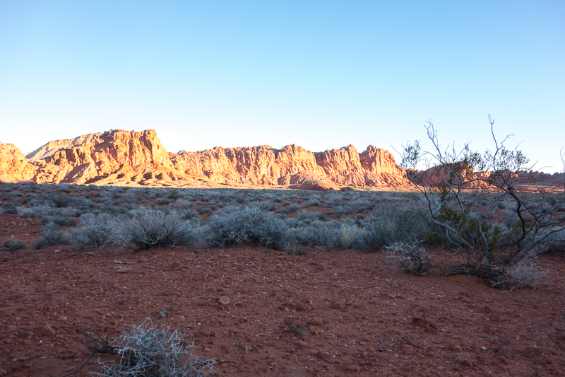
Here you can see the sun has hit the red rock formations just north of me and I am waiting for the line of light and dark, the border of cold and warm, to inch its way to my campsite. When the sun beams reached me, it was time to get up. I walked a few yards to relieve myself. My urine was clear, but when it puddled on the ground it immediately turned aquamarine before dissipating into the soil. I definitely need to research this aquamarine phenomenon.
I ate my normal breakfast of instant oatmeal, drank a cup of coffee, and quickly packed up. I had about 6 hours of time to further explore the bowl and then hike out to my rendezvous point with Joyce in the early afternoon.
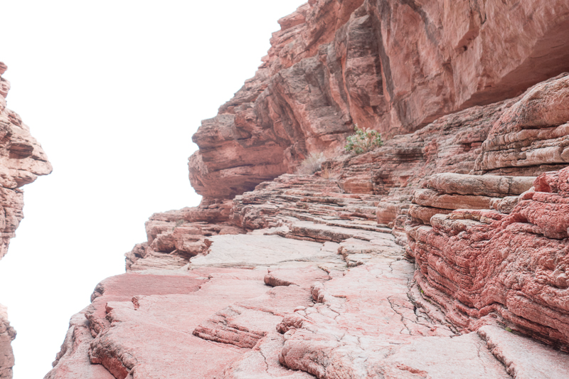
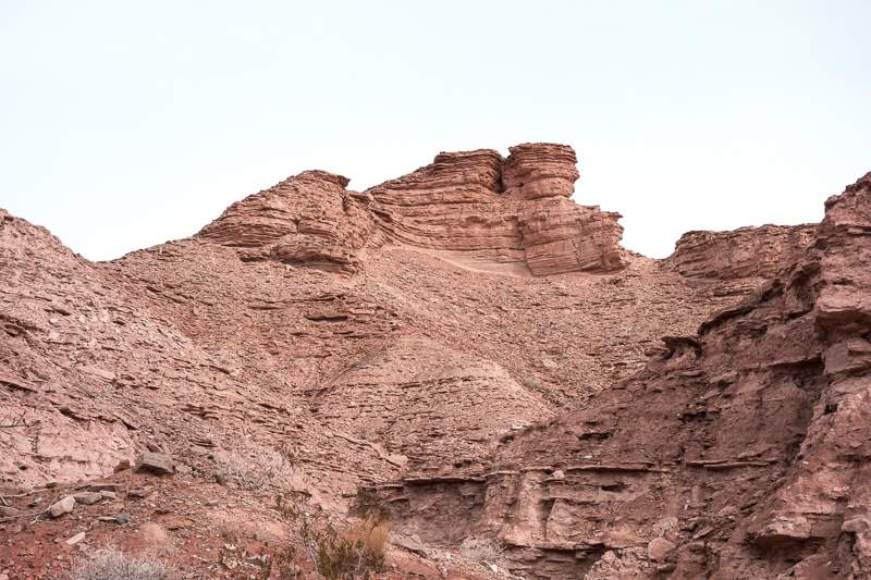
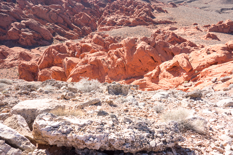
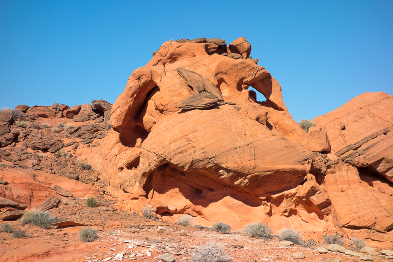
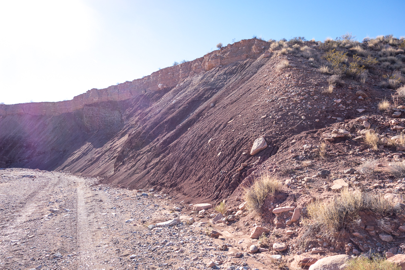
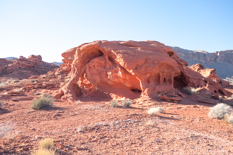
In the above picture you can see the “muddy” limestone that covers the red sandstone. Over time, a very long time, the limestone is eroded by wind and water exposing the sandstone. Then the erosion process starts sculpting the sandstone into the wonderful formations I share in earlier photos.
Right after Christmas a cold (sub freezing) front was about to hit Nevada, so we went south to Joshua Tree National Park in California.