As you probably know, I often do short backpacking trips when I travel on business. Most of these trips don’t lend themselves for a lot of advance planning. I look at a map, determine the elevation differences from where my meeting is and where I might hike, look at the weather forecast, pack what seems to be the required gear, and then hop on a plane. Often I don’t know exactly where I will hike; that is something I sort out when I get to my destination.
And that is how it was this week.
Travel to Columbia, South Carolina and possibly take a trip to the Sumter National Forest.
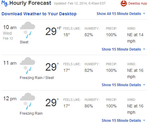
Last week the weather forecast was for daytime highs in the 50s, and nighttime lows around freezing. However, when I got here it was a little different. The forecast was now a “devastating” winter storm. This was due to predicted icy roads covered by snow, and then a constant mix of snow, sleet and rain. A storm like this would cause few problems in the northeast, but the southern states do not have the infrastructure to handle severe weather, which is a rarity.
The Governor has declared a state of emergency, roads and businesses are closed, and travel on the ice covered roads is not safe. Hundreds of thousands of people in the area are without power.
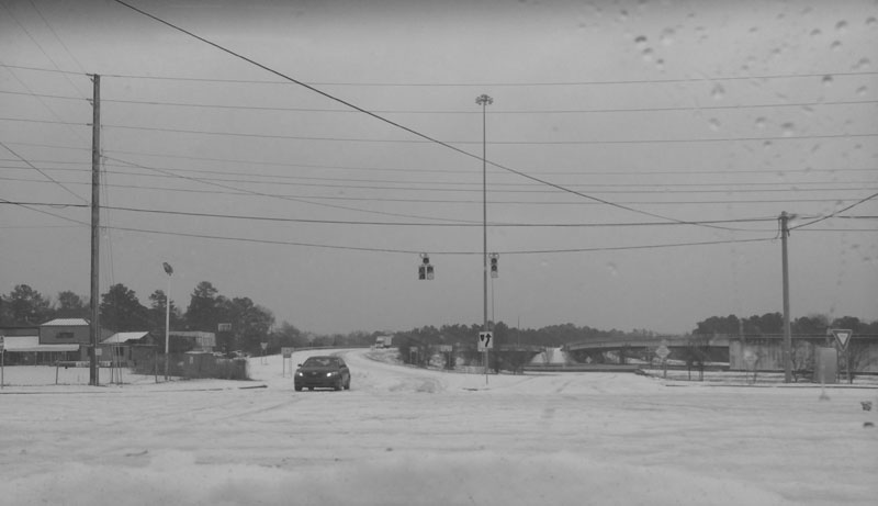
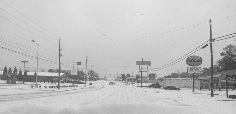
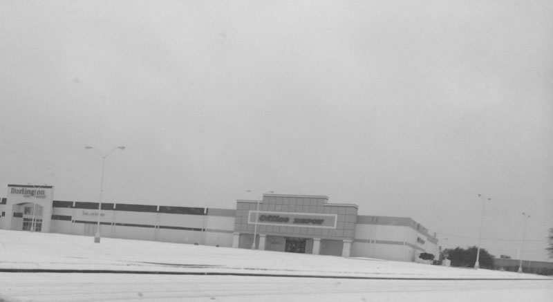
And my business trip is cancelled, as the client closed. Flights are cancelled. Seems like the perfect opportunity to go backpacking!
know when to fold ’em…
Whenever planning a backpacking trip, the hiker must be aware of the predicted weather. For long trips the hiker must be aware and prepared for extreme swings in the weather, and a historical table is helpful. The charts below show the average temperatures and the historical lows. Also is important to look at historical data for precipitation.
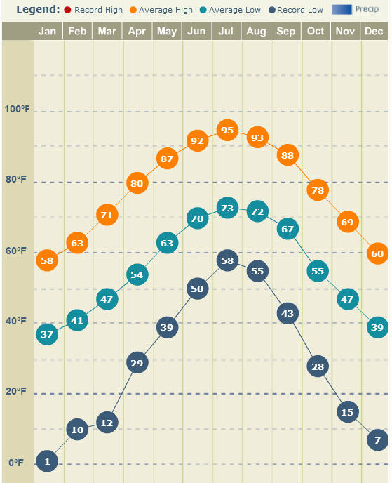
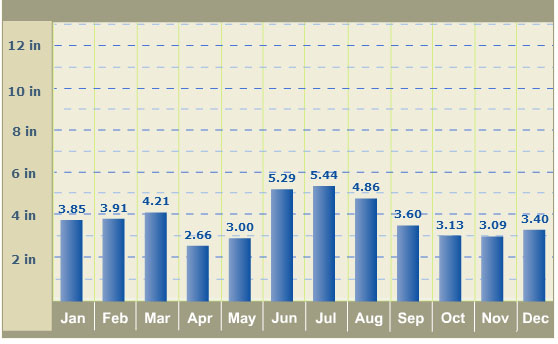
The charts are for Columbia, which is at 300 feet elevation. The Sumter National Forest ranges from 800 – 3,400 feet, meaning temperatures are lower and precipitation higher. But it doesn’t matter… I decided not to go. The weather I was experiencing in the city was the worst kind of weather possible, and it would probably be similar where I was planning to go. Temperatures around freezing, rain/sleet, and wind combine for the perfect hypothermia storm. The conditions make it very difficult to stay warm and dry, and I was not prepared.